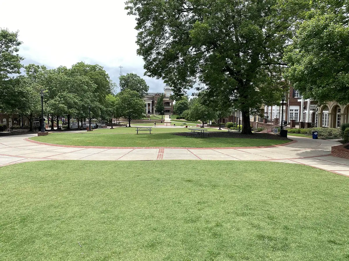
Duluth's 10 main areas, from downtown to the Chattahoochee River side: ZIP codes, zoned schools and August 2026 Zillow home values, with a map.
Last checked Oct. 6, 2026. Sources: the City of Duluth’s Plan 2040 comprehensive plan (PDF), Character Area Map (PDF) and GIS layers, Gwinnett County’s city boundary and address data, Gwinnett County Public Schools’ zone map data and Find My School tool, the state’s 2025 School Grades data, Zillow Research, the Census Bureau and OpenStreetMap.
Duluth is a city of 32,426 people in western Gwinnett County, according to the Census Bureau’s 2020-2024 American Community Survey five-year estimates. It covers about 10 square miles in Gwinnett County’s city boundary data. The Chattahoochee River is its northern and western edge and the line with Johns Creek. Peachtree Industrial Boulevard (Georgia 141) crosses the north and west of the city, Buford Highway (U.S. 23) and the Norfolk Southern railroad run through the middle, and downtown sits where Buford Highway meets Duluth Highway (Georgia 120). There is no interstate inside the city: I-85 is to the southeast. A Duluth mailing address does not mean a home is in the city; the tax district on a parcel’s record in the Gwinnett County Tax Commissioner’s property search shows whether it pays the city’s tax.
Three things to know before you look at a listing:
- Two main ZIP codes. Counting the city’s house and townhome parcels and Gwinnett County’s apartment and condo address points, 70% of home addresses in the city are in 30096, mostly the south and middle, and 29% in 30097, mostly the north. About 1%, at the northeast end, are in 30024. Both Duluth ZIP codes also reach well outside the city.
- Most of the city is one high school zone. In Gwinnett County Public Schools’ zone layers, updated in August 2026, 90% of home addresses are zoned for Duluth High and 10%, on the east side and around Sugarloaf, for Peachtree Ridge High. Elementary zones split much more. School zones do not follow city limits; always check one address with the GCPS school locator.
- About a third of the city’s homes are apartments. Of about 14,700 home addresses we counted, 43% are houses, 35% apartments, 17% townhomes and 5% condos. The apartments are concentrated downtown, along Pleasant Hill Road and Peachtree Industrial Boulevard, and in North Berkeley.
The areas at a glance
Typical home value is the Zillow Home Value Index for the area’s main ZIP code in August 2026: a modeled typical value for the middle third of homes, not a sale price. It is a ZIP code figure, so it is the same for every area in that ZIP code.
| Area | Main ZIP | Zoned high school | Typical home value (ZIP) | Guide |
|---|---|---|---|---|
| Downtown | 30096 | Duluth | $408,260 | Downtown |
| Core neighborhoods | 30096 | Duluth | $408,260 | Core neighborhoods |
| Rogers Bridge Road and Albion Farm | 30097, 30096 | Duluth | $710,739 (30097) | Rogers Bridge Road |
| Chattahoochee River side | 30097 | Duluth | $710,739 | River side |
| Howell Ferry Road | 30096 | Duluth | $408,260 | Howell Ferry Road |
| Pleasant Hill Road and Peachtree Industrial | 30096 | Duluth | $408,260 | Pleasant Hill Road |
| Bunten Road and Duluth Highway | 30096, 30097 | Peachtree Ridge 71%, Duluth 29% | $408,260 (30096) | Bunten Road |
| Sugarloaf | 30097, 30024 | Peachtree Ridge 59%, Duluth 41% | $710,739 (30097) | Sugarloaf |
| South Buford Highway and Davenport Road | 30096 | Duluth | $408,260 | South Buford Highway |
| North Berkeley | 30096 | Duluth | $408,260 | North Berkeley |
For comparison, the citywide Duluth figure was $437,770, down 2.5% from August 2025. ZIP 30096 was down 2.1% and 30097 down 0.4% on the year. Duluth High scored 70.0 and Peachtree Ridge High 77.7 on the state’s 2025 College and Career Ready Performance Index; the state average was 78.0. More in our home prices guide and schools guide.
Map of the areas
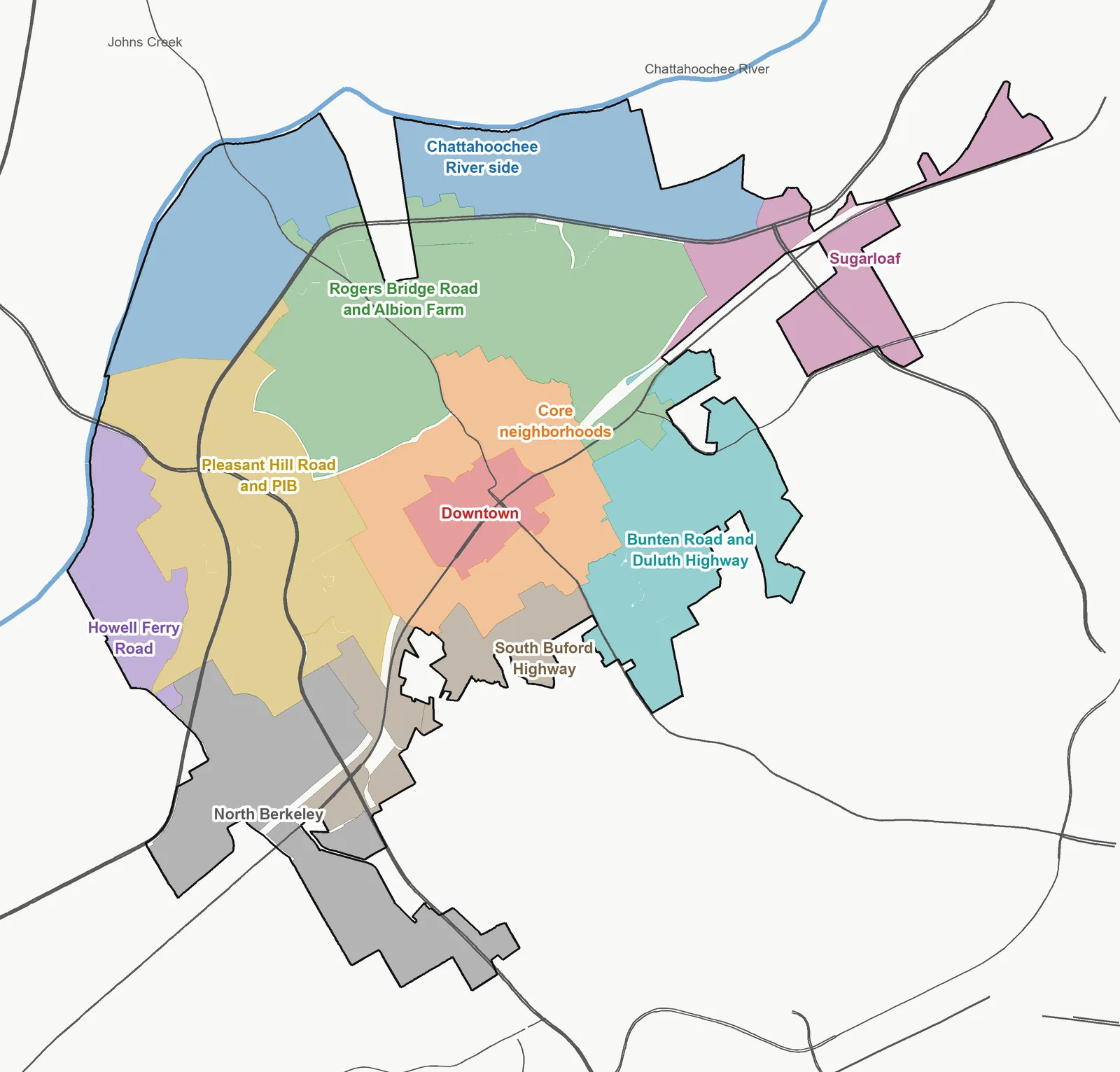
Map by Duluth Journal. Areas are the City of Duluth’s character area polygons, grouped as described below; city limits from Gwinnett County; roads and the river from OpenStreetMap, © OpenStreetMap contributors.
The areas
Downtown. The Town Green, City Hall and Parsons Alley at Buford Highway and Duluth Highway. About three in four homes are apartments, among them The District at Duluth and Everleigh. All of it is zoned for Duluth High. Restaurants and events are in our downtown Duluth guide.
Core neighborhoods. The ring of neighborhoods around downtown that the plan divides into Pinecrest, the Hill community, Hall Circle, and McClure Place and Willbrooke. Mostly houses, with some townhomes; Duluth High is inside it.
Rogers Bridge Road and Albion Farm. The city’s largest stretch of single-family subdivisions, between downtown and Peachtree Industrial Boulevard, including Riverbrooke and The Village at Albion Farm. All zoned for Chattahoochee Elementary, Coleman Middle and Duluth High.
Chattahoochee River side. The land between the boulevard and the river, which the plan reserves for houses and townhomes, plus the River Green business park. Rogers Bridge Park is here. All in ZIP 30097.
Howell Ferry Road. Four single-family subdivisions on the river at the city’s western edge: Sweet Bottom Plantation, Howell Wood, Whitney Park and Berkeley Park.
Pleasant Hill Road and Peachtree Industrial. The city’s largest group of apartment communities and its Medical District, with about 4,400 home addresses, the most of any area.
Bunten Road and Duluth Highway. East-side subdivisions such as Norman Downes and Cresswell, mostly zoned for Peachtree Ridge High, with Bunten Road Park and Mason Elementary.
Sugarloaf. The northeast tip at Peachtree Industrial and Sugarloaf Parkway, with apartments, townhomes and houses split among four elementary zones.
South Buford Highway and Davenport Road. Ennfield, Forest Manor North and Regency Park behind the auto-service strip of Buford Highway, and the Southeastern Railway Museum. The shortest drive to I-85 of any area.
North Berkeley. The southern tip on Pleasant Hill Road, with shopping centers, the city’s main industrial district, apartments and the only Ride Gwinnett stops inside the city.
How we built this
We named only areas a public source places on a map. The sources were:
- The city’s own plan and map. Duluth’s Plan 2040 comprehensive plan divides the city into character areas, each with its own goals, and the city publishes the current Character Area Map and a GIS version of it. Each of our areas is one or more of those polygons. Where the city’s Established Neighborhoods area is split into separate pieces, we joined each piece to the character area next to it and named it for its main road.
- The city’s development layer, which names 103 subdivisions, townhome communities and apartment complexes inside the city. We name a subdivision only when that layer, the county’s address data or OpenStreetMap names it.
- The city’s parcel layer and Gwinnett County’s address points, used to count homes: every house and townhome parcel and every apartment and condo address. Office and retail condos are left out.
- Gwinnett County Public Schools’ zone layers, updated in August 2026, matched to every one of those home addresses on Oct. 6. The district paused its planned redistricting on Sept. 24, 2026, and said it will not weigh boundary changes for 2027-28 this fall; see our schools guide.
- Place names and stores from OpenStreetMap, © OpenStreetMap contributors.
We do not rank areas. Every figure on these pages is from a named public source; if you see one that is out of date, tell us on our corrections page.
Frequently asked questions
What are the neighborhoods in Duluth, Georgia?
Our guide covers 10 areas: downtown, the core neighborhoods around it, Rogers Bridge Road and Albion Farm, the Chattahoochee River side, Howell Ferry Road, Pleasant Hill Road and Peachtree Industrial, Bunten Road and Duluth Highway, Sugarloaf, South Buford Highway and North Berkeley. They follow the character areas in the city’s Plan 2040.
What ZIP codes are in Duluth, Georgia?
Mostly 30096 and 30097. Counting the city’s parcels and Gwinnett County’s address points, 70% of home addresses inside the city are in 30096, 29% in 30097 and 1%, at the northeast end, in 30024.
What high school is Duluth zoned for?
Mostly Duluth High. In Gwinnett County Public Schools’ 2026 zone map, 90% of home addresses in the city are zoned for Duluth High and 10%, on the east side and around Sugarloaf, for Peachtree Ridge High.
Is Duluth on I-85?
No. I-85 runs southeast of the city. From the middle of our 10 areas, the nearest exit is 3.4 to 5.3 miles away by road: exit 104, Pleasant Hill Road, from the south and west; exit 107, Duluth Highway, from downtown and the east; and exit 109, Old Peachtree Road, from Sugarloaf and the river side.
Does a Duluth mailing address mean the home is in the city?
No. Duluth ZIP codes reach well outside the city limits. Look up the parcel with the Gwinnett County Tax Commissioner to see which tax district it is in.
Have your say